Layered Map Sample
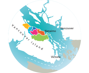
Instructions:- Please click on the numbers below (1-7) to access a specific Region
- Then use the tabs below the Region Map to add layers
- Be sure to scroll down to see Layer Detials
Please note that this is a Developmental Version of the Layerd Map System

1
Big
Qualicum
Qualicum
2
Little
Qualicum
Qualicum
3
French
Creek
Creek
4
Englishman
River
River
5
Nanoose
5
Lantzville To
South Wellington
South Wellington
6
Nanaimo
River
River
6
Cedar-Yellow Point
7
Gabriola
Island
Island
QUALICUM BEACH
PARKSVILLE
LANTZVILLE
NANAIMO
