Building & Bylaw ServicesCorporate Services Current PlanningDrinking Water & Watershed ProtectionEconomic DevelopmentEmergency ServicesEnergy & SustainabilityGIS/MappingLong Range PlanningParksRecreationRegional TransitSolid Waste and RecyclingWastewater ServicesWater & Utility ServicesServices by Others
Trans Canada Trail
Notice of Improvements - TCT Timberlands Rd Parking Lot and Access Trail
Click Here for more information
Click Here for more information
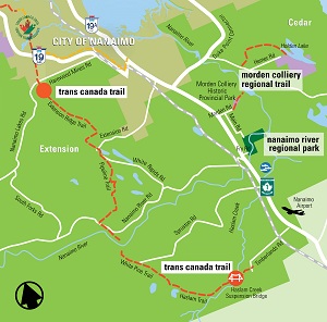
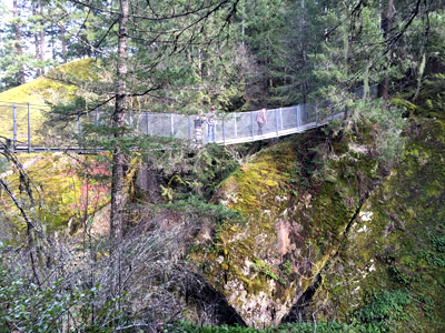
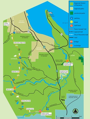
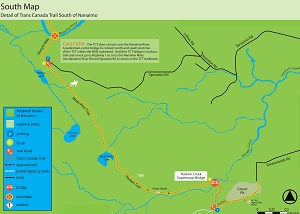
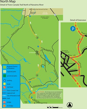
Building on the hard work of Nanaimo area Trans Canada Trail (TCT) volunteers, the RDN officially opened the first piece of TCT between the City of Nanaimo and the Cowichan Valley Regional District in early 2001. Key links in the still roughly developed backwoods TCT route include the Extension Ridge, Pipeline, White Pine and Haslam Trails. Most of the approximately 20 kilometres of trail is situated on private forest lands, licensed public access to which is greatly appreciated. An impressive suspension bridge over Haslam Creek was installed in 2002 and a crossing over the Nanaimo River to link north and south stretches of the RDN's TCT will be completed in the years to come. From the Haslam Creek Bridge and Timberlands Road area, continue trekking south to Ladysmith on the Cowichan Valley Trail. For information on the TCT in the Cowichan Valley, contact CVRD Parks at 250-746-2620.
Things To Do
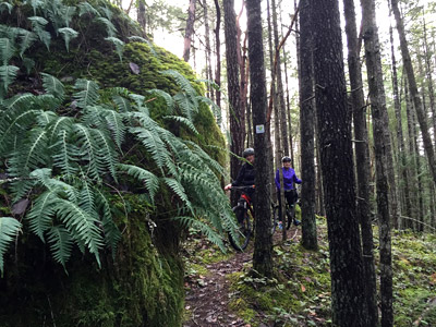
Hiking, mountain biking, horseback ridingHow To Get There
- Extension Ridge trailhead: on Harewood Mines Rd, at the end of the City of Nanaimo's Colliery Dam Trail. Pipeline trailhead: in the community of Extension at the end of Bramley Rd beside the Volunteer Fire Department building or at Nanaimo River Rd by the two large blue waterline vent pipes.
- White Pine and Haslam trailheads: at the end of Spruston Rd by McKay Lake or off the end of Timberlands Rd (across Hwy 1 from the Nanaimo airport).
Please note:
Trail users should note that within the Regional District of Nanaimo the Trans Canada Trail is under development and very primary trail markers and trail development/improvements are in place. As this is a backcountry trail, be properly prepared for the trek. Ensure your clothing and footwear are appropriate for the terrain, that you have sufficient water and snacks, that you have left no valuables in your vehicle, and that your vehicle is parked clear of gates or other traffic.The bridge crossing at the Nanaimo River is still is in the concept development phase. Wading or swimming in the river is not recommended.


Georeferenced PDF Map
Park Location
click maps for larger versionsWhole Park Map

TCT South End

TCT North End Map


