Building & Bylaw ServicesCorporate Services Current PlanningDrinking Water & Watershed ProtectionEconomic DevelopmentEmergency ServicesEnergy & SustainabilityGIS/MappingLong Range PlanningParksRecreationRegional TransitSolid Waste and RecyclingWastewater ServicesWater & Utility ServicesServices by Others
Electoral Area G
Dashwood, French Creek, San Pareil, Rivers Edge Community Parks
The VISION for the Community Parks and Trails in Electoral Area G is to provide"a vibrant community where residents can easily access community parks and beaches through a system of inter-connected trails that provides for recreation, social interaction and nature appreciation."
- Community Parks and Trails Strategy, 2013
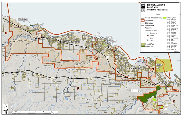
Electoral Area G has 39 community parks (55.4 hectares; 136.9 acres). See map below for existing park locations.

Click map to download large PDF version
For further information on the Community Parks and Trails Strategy (2013) click here.
