Parksville - Qualicum Beach Links

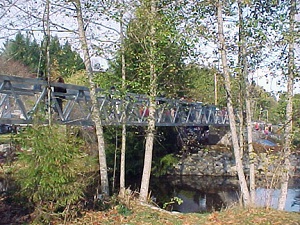
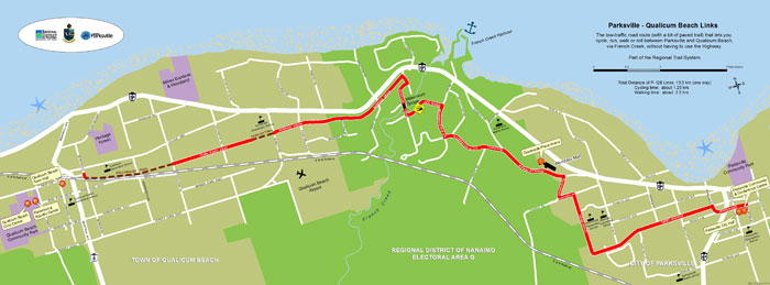
Want to cycle, walk, run or roll between the City of Parksville and the Town of Qualicum Beach without having to use Highway 19A? The Parksville-Qualicum Beach Links is a 13 kilometre low-traffic road route that connects the City and Town via French Creek (Electoral Area G). The Links features a pleasant suburban road network with only one hill, an accessible pedestrian-cyclist bridge over French Creek, and two stretches of paved trail at the Qualicum Beach end. The whole way is marked with signage directing users to Parksville or Qualicum Beach.
things to do
Cycling, running, rolling, walking
how to get there
At the Qualicum Beach end, the Links start behind the QB Legion where the Dollymount Trail meets Berwick Rd. At the Parksville end, the Links start at City Hall on Jensen Ave. The entire way is marked with pedestrian/bicycle route signage.

